
Independent Evidence Replication — Cadastral boundary
A practical Independent Evidence Replication workflow for Cadastral boundary, focused on evidence, timing, record reconciliation, exception closure and an auditable decision.
Verified facts relevant to this topic
Purpose of this guide
Independent Evidence Replication — Cadastral boundary applies an operational verification workflow to Cadastral boundary. The specific objective is to rebuild the conclusion through a second reviewer using the same primary evidence so the decision does not depend on a non-repeatable individual interpretation. A fact should not be treated as operationally reliable merely because it exists; it must be tied to the correct property, party and date and supported by evidence that another reviewer can audit later.
When to use this review
- Before signing a contract or amendment that changes rights or obligations.
- Before sending money or changing a beneficiary or account.
- When a new version of a previously relied-on document arrives.
- When there is reviewer disagreement or a high consequence of potential error.
- When the database and a primary document or official source disagree.
- Before final closing when the information can change over time.
Evidence file
- Retain the source or document actually used for the decision.
- Record retrieval/receipt date and reviewer identity.
- Link the version to the correct property, unit and counterparty.
- Preserve prior versions when a document changes.
- Record any difference between the database and primary evidence.
- Do not fill missing fields with undocumented estimates.
Consistency tests
- Does every item refer to the same property and unit?
- Are party identities and legal capacities consistent?
- Is the date suitable for the moment on which the decision relies?
- Are amounts, rights and restrictions consistent across records?
- Does a material fact appear in only one source without explanation?
- Has anything changed since the last review that could alter the decision?
Verified facts from official sources
Cadastral boundary verification
Replicate a critical check through an independent official channel when the financial decision is material.
Practical FAQ built from the record’s verified facts
What official fact about cadastral boundary should a buyer verify when two document versions differ?
Do not rely only on fences, current occupation or an online map. Tie the boundary to the correct ada/parsel and cadastral record, and obtain an official aplikasyon or survey when there is doubt or conflict. Replicate a critical check through an independent official channel when the financial decision is material.
Which document fields or legal details on cadastral boundary matter most when two document versions differ?
Replicate a critical check through an independent official channel when the financial decision is material. Do not rely only on fences, current occupation or an online map. Tie the boundary to the correct ada/parsel and cadastral record, and obtain an official aplikasyon or survey when there is doubt or conflict. TKGM guidance explains that aplikasyon re-establishes parcel corners and boundaries on the ground from cadastral data, while public map-query information is not by itself a final transaction document.
What can go wrong with cadastral boundary when two document versions differ, and what evidence resolves it?
TKGM guidance explains that aplikasyon re-establishes parcel corners and boundaries on the ground from cadastral data, while public map-query information is not by itself a final transaction document. Replicate a critical check through an independent official channel when the financial decision is material.
Sources for this section were reviewed on 16 August 2026.
Evidence and decision plan for Independent Evidence Replication — Cadastral boundary
“Independent Evidence Replication — Cadastral boundary” should be handled as a decision file, not as a collection of documents. Its working objective is to organize the file so an independent reviewer can reproduce the same conclusion without relying on the original adviser’s assertion. Evidence is useful only when it can be tied to the same property, party and decision date.
Evidence to assemble
- For “Independent Evidence Replication — Cadastral boundary”, match the property and party identifiers in the evidence to the asset and people actually involved; a correct document for the wrong unit or person does not close the check.
- For “Independent Evidence Replication — Cadastral boundary”, record issuer, source, issue or retrieval date and version where available, then distinguish an original/current record from a scan, translation, draft, expired copy or superseded version.
- For “Independent Evidence Replication — Cadastral boundary”, compare documentary status with the physical, payment or operational reality relevant to the topic and write down every unexplained difference before commitment.
- For “Independent Evidence Replication — Cadastral boundary”, convert each unresolved difference into a named condition: evidence required, person responsible, deadline and the consequence if the condition is not satisfied.
Official reference to recheck
The source register for “Independent Evidence Replication — Cadastral boundary” includes TKGM — Parcel Query (https://parselsorgu.tkgm.gov.tr/). Use that source for the matters within its authority and recheck it when timing or rules are material; it does not replace a registry, engineering, tax, banking or contractual record that the specific decision separately requires.
Decision boundary
The decision for “Independent Evidence Replication — Cadastral boundary” is not “document present / document absent.” It is whether the evidence is current, identifies the right asset and parties, resolves material conflicts and supports the next irreversible step.
Independent evidence replication — cadastral boundary
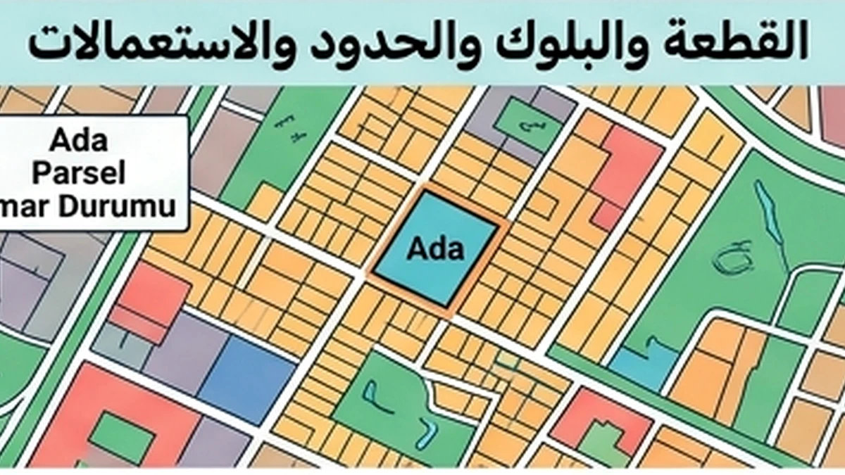
A listing map, fence line or seller sketch is not independent evidence of a cadastral boundary. Reproduce the result from cadastral sources: match province, district, neighbourhood, block and parcel; inspect the parcel geometry available through TKGM; and obtain a formal boundary-setting or application sketch when the on-ground line matters to the transaction. TKGM describes the application sketch as showing identified boundaries and boundary points, measurements and, where observed, encroaching use.
If independent evidence conflicts with the seller’s representation, do not select the more convenient version. Determine whether the difference comes from a cadastral update, technical correction or a physical fence that does not follow the registered boundary. Preserve the independently obtained output, date and reference so another reviewer can repeat the check.